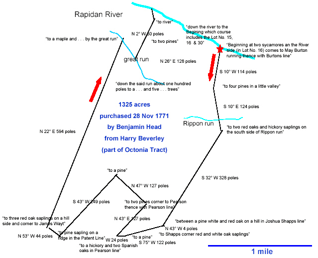
This is a map made based on information given about the land based on Metes and Bounds. Before the PLSS, property was explained using metes and bounds. The process used georeference points to explain where a articular piece of property began, things like large trees, rivers, hills, etc. The method was very unsytematic and left lots of room for error. When examining old records it could be hard to understand the current property rights because trees may have been cut down, rivers changed their flow and other events. The above image details a piece of property in virginia owned my James Madison.
No comments:
Post a Comment